


Winter hikes in the Allgäu: The most beautiful routes in November
Winter hikes in the Allgäu: The most beautiful routes in November
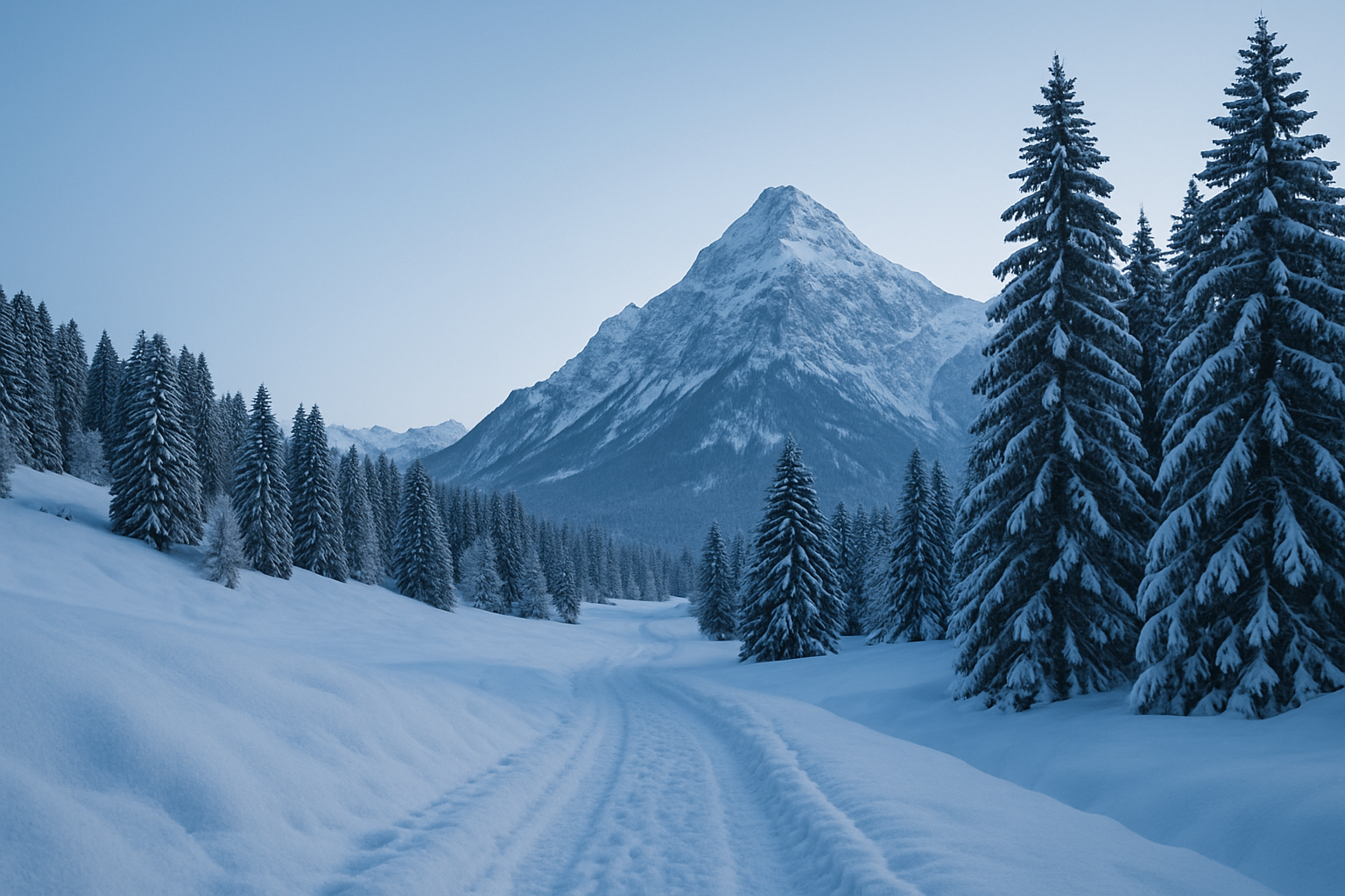
When the first snow gently drifts across the Allgäu mountains, the region transforms into a magical winter wonderland. Especially in November, when the paths are still easily accessible and nature displays its winter tranquility, numerous winter hiking trails in the Allgäu invite you to unforgettable snowshoe hikes. In this guide, you'll find everything you need to know about cleared winter hiking trails throughout Bavaria, spectacular panoramic views, and family-friendly winter walks in the Allgäu – specific, informative, and with real tour tips. Included are classics like the winter hike to the Alpe Obere Kalle, the panoramic highlight of Falkenstein, and the idyllic loop to Christlessee. Let yourself be inspired and discover the magic of snowshoeing in the Allgäu – ideal for kicking off the winter season!
- 1. Why go winter hiking in the Allgäu region in November?
- 2. Top 5 winter hikes for beginners in the Allgäu
- 3. More challenging tours for advanced and professional skiers
- 4. Winter hikes with a stop at a mountain hut
- 5. Safety & Equipment for Winter Hiking
- 6. Large comparison table of routes
- 7. Frequently asked questions about winter hikes in the Allgäu region
- 8. Conclusion: How to properly enjoy winter in the Allgäu
Why go winter hiking in the Allgäu region in November?
Ideal conditions in early winter
November is perfect for snowshoeing in the Allgäu region: Even before the start of the ski season, many winter hiking trails are already cleared or easily accessible. Fresh powder snow, clear air, and moderate temperatures ensure ideal hiking conditions – without crowded paths.
Tourist advantages of the off-season
Since the big winter sports rush usually doesn't start until December, you can enjoy a particularly peaceful atmosphere in November. Parking is free, accommodations are cheaper, and mountain huts are already heated up again. Many winter hiking trails in the Allgäu region, especially in the south and west, are groomed early in the winter.
Special features of the Allgäu snowscape
- The Tannheim Valley and the area around Balderschwang offer snow-covered coniferous forests.
- Picturesque alpine pastures with views can be found, for example, at the Alpe Gschwenderberg or the Obere Kalle.
- Fascinating frozen bodies of water, such as the Christlessee near Oberstdorf
Advantages of winter hikes in November
- Fewer people on the paths
- Cleared paths from mid-November
- Often still low avalanche risk – ideal for beginners
Recommended regions based on snow conditions
- East Allgäu (Reuterwanne, Falkenstein): often snowed in early morning
- Southern Allgäu (Oberstdorf, Gunzesried): varied routes & high valleys
- Western Allgäu (Balderschwang, Hündle): roads will be safely cleared from November onwards.
Top 5 winter hikes for beginners in the Allgäu
Winter hike to the Obere Kalle alpine pasture
An ideal introductory tour for beginners is the winter hike to the Obere Kalle alpine pasture near Gunzesried. From the parking lot in the village center, you follow a moderately ascending path through the pastureland. After about 1.5 hours in total, you reach the tranquil alpine pasture with its view of the Nagelfluh mountain range.
- Difficulty: easy
- Duration: approx. 1.5 hours
- Elevation gain: approx. 150–200 m
- Special features: Snowy slopes, suitable route for families
Oberstdorf – Moorweiher – Christlessee
This two-hour hike starts at the spa park in Oberstdorf and leads past the moorland pond to the crystal-clear Christlessee lake , which never freezes over in winter. The tour is particularly popular with families due to the gentle incline and the inviting café of the same name.
- Difficulty: easy
- Duration: approx. 2 hours
- Elevation gain: approx. 100 m
- Special features: Pond landscape, refreshment stop along the way
Valley loop Balderschwang – Aibele Alpe
Starting from the parking lot by the church in Balderschwang, a cleared winter path leads along a romantic stream to the Aibele Alpe – a roughly 1.5–2-hour circular hike. Refreshments are often available (even in winter) – making it ideal for beginners or families looking for a light snack at the end of the hike.
- Difficulty: easy
- Duration: 1.5–2 hours
- Elevation gain: approximately 150 meters
- Special features: Cleared, with a place to stop for refreshments
Winter hike to the Gschwenderberg alpine pasture
From the Immenstadt district of Gschwend, the trail climbs gently for about an hour until you reach the idyllic Gschwenderberg alpine pasture above the Alpsee lake. The tour is particularly suitable for beginners on firm snow trails.
- Difficulty: easy
- Duration: 2 hours (round trip)
- Elevation gain: approx. 200 m
- Special features: View of the Großer Alpsee lake
Circular hiking trail at Hündle near Oberstaufen
A groomed winter hiking trail with typical Allgäu panoramic views: The Hündle circular trail leads you gently through snow-covered highlands in about 2 hours and offers fantastic views of the Nagelfluhkette mountain range. The starting point is at the valley station of the Hündle cable car.
- Difficulty: easy
- Duration: 2 hours
- Elevation gain: 250 m
- Special features: Popular panoramic view, regularly cleared
More challenging tours for advanced and professional skiers
Reuterwanne – Panoramic views for experienced hikers
From the parking lot at the entrance to Wertach , the hike to the Reuterwanne summit takes about 3-4 hours. You'll climb a considerable 500-600 meters in altitude, but you'll be rewarded with panoramic views in all directions of the Allgäu Alps. The trail is often tracked, but only recommended for sure-footed hikers.
Mittagberg plateau from Immenstadt
The summit hut on the Mittagberg mountain is open between autumn and spring – ideal for a challenging but rewarding hike. The starting point is the valley station of the Mittagbahn cable car in Immenstadt. You ascend via well-maintained, sometimes steep paths to the panoramic plateau with views stretching as far as Lake Constance.
- Duration: 4–5 hours (round trip)
- Elevation gain: approx. 700 m
- Recommended with: Snowshoes (in fresh snow)
Winter hike to the Kappeler Alp
The winter route, which takes approximately 2.5–3 hours and ascends steadily, begins in Pfronten-Kappel . The Kappeler Alp is also open in winter and offers a fabulous view of the Falkenstein ruins.
- Elevation gain: approx. 450 m
- Information: Spikes recommended in icy conditions, prepared path
Falkenstein – Germany's highest castle ruins
A somewhat challenging but particularly rewarding hike to the Falkenstein in the Ostallgäu region . You hike from the Burghotel in Pfronten-Meilingen to the summit, home to Germany's highest castle ruins (1268 m), in about two hours. Recommended only in safe snow conditions!
- Duration: 4 hours total
- Elevation gain: 650–700 m
- Avalanche situation: check!
Chamois Winter Trail to Haldensee
Starting in Grän (Tyrol) , near the border with the Allgäu region: The Gämsbockweg trail leads to the frozen Haldensee lake in about 2.5 hours. Particularly atmospheric with fresh snow, moderate incline of around 300 meters.
- Region: Tannheim Valley
- Difficulty: medium; trail signposted & popular
Winter hikes with a stop at a mountain hut
| name | Opening hours (winter) | Special features |
|---|---|---|
| Aibele Alpe | Often open from mid-November (weekends) | Warm soup & hearty snack |
| Gipfelstube Mittagberg | Usually open when the lift is operating | View of Lake Constance, sunny terrace |
| Kappeler Alp | Managed Nov.–Feb. | Panoramic view & Kaiserschmarrn |
| Café Christlessee | Open daily – weather permitting | Indoor & terrace, romantic |
| Alpe Gschwenderberg | Partially open – check! | View of the Alpsee |
Tips for family-friendly places to eat
- Christlessee Café with changing area & short distance
- Alpe Obere Kalle: sunny & sheltered location
Where can I find mulled wine and hot soup?
- Kappeler Alp: Mountain punch in the snow basin
- Summit hut at lunchtime: Käsespätzle & warmth!
Safety & Equipment for Winter Hiking
Safety check before takeoff
- Check the avalanche bulletin (e.g. LWD-Bayern.de )
- Check weather forecast including wind & visibility
- Prepare tour route on GPS or map
Checklist: Winter hiking equipment
- Waterproof, warm shoes
- Hiking poles with snow baskets
- Thermal clothing in layers
- First aid kit, mobile phone, headlamp (!)
Weather conditions and twilight
In November, it gets dark by 4:30 pm at the latest. Start early, and shorten your tour if there is a risk of falling!
Comparison table: The best winter hiking trails in the Allgäu region
| Route name | difficulty | Length of time | Elevation gain | region | Is it possible to stop for refreshments? | Avalanche danger | Family-friendly |
|---|---|---|---|---|---|---|---|
| Alpe Obere Kalle | light | 1.5 h | 180 hm | Southern Allgäu | usually not | No | Yes |
| Reuter tub | medium | 3–4 h | 550 m | Ostallgäu | no | Small amount | Restricted |
| Mittagberg plateau | medium | 4–5 h | 700 hm | Central Allgäu | Yes | no | no |
| Christlessee Round | light | 2 h | 100 hm | Southern Allgäu | Yes | no | Yes |
| Kappeler Alp | medium | 2.5–3 h | 450 m | Ostallgäu | Yes | small amount | conditional |
| Falkenstein | difficult | 4 h | 700 hm | Ostallgäu | no | possible | no |
| Aibele Alpe | light | 1.5–2 h | 150 hm | Western Allgäu | Yes | no | Yes |
| Gschwenderberg | light | 2 h | 200 hm | Central Allgäu | partially | no | Yes |
| Hündle circular trail | light | 2 h | 250 m | Western Allgäu | no | no | Yes |
| Chamois Trail | medium | 2.5–3 h | 300 hm | Tannheimer Valley | no | small amount | conditional |
The most important information at a glance
- November offers ideal conditions for safe snowshoeing in the Allgäu region.
- Many paths have already been cleared and are family-friendly.
- Recommendation: Start early, use tested routes, wear appropriate clothing
- Top tours: Alpe Obere Kalle, Falkenstein, Aibele Alpe, Mittagberg plateau
- Mountain huts with refreshments: e.g. Kappeler Alp, Gipfelhütte Mittag